Imray charts, much loved by yachtsmen, are produced by Imray Laurie Norie & Wilson, a company with a very long history in the chart-making business. Until the First World War their famous “Blueback” charts were the preferred choice of professional mariners.
Modern Imray charts are compiled in-house using data from the UK Hydrographic Office (UKHO / Admiralty) and other official hydrographic sources. They can therefore be considered fully equivalent in navigational accuracy for their intended purpose. Imray charts have also been awarded official recognition by the Maritime and Coastguard Agency (MCA) for carriage on coded vessels under 24m and on fishing vessels under 24m in length.
Much detail of no relevance to the small-craft sailor is omitted, while plans and insets of great importance to yachtsmen are often placed in otherwise redundant areas of the chart. This results in charts that are clear, practical, and very good value for money for leisure navigation.
All Imray charts are printed on Pretex, a partially synthetic paper that folds well and is highly durable in damp conditions. It accepts both soft pencil and ballpoint pen. Users accustomed to the heavier cartridge paper of UKHO charts may find the semi-synthetic surface slightly less pleasant to work with, but its durability is widely appreciated in the yachting environment.
Imray publishes several ranges of charts covering areas popular with yachtsmen, including Northwest Europe, the Mediterranean, and the Caribbean. In addition, Imray Laurie Norie & Wilson commission and publish a large range of pilot books and cruising guides for these and many other cruising areas.
C Series Charts
In Northwest Europe, including the UK, Imray’s C Series charts are of a suitable scale for coastal passage making. All Imray charts are normally folded to approximately A4 size and supplied in robust PVC wallets.
Dimensions:
C Series charts: 787 × 1118 mm (31″ × 44″)
Y Series Charts
The Y Series charts are generally of a larger scale than the C Series and are intended primarily for rivers, harbours, and confined waters.
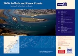
2000 Series Chart Folios
The “2000” small-format chart folios are A2 in size and are supplied as booklets, typically consisting of 10 charts covering a specific area. They are particularly convenient for cockpit use and small chart tables.
Corrections
Charts are normally reprinted at intervals of about two years, at which time they are fully corrected to the latest available information. Once a new edition has been published, the previous edition is no longer maintained by the publisher and should not be relied upon for safe navigation.
Corrections issued after printing are made available as Correction Notices, which may be downloaded from the Imray website. These are regularly updated and should be checked frequently. Imray also increasingly supports digital correction access and electronic chart products through its own platforms and commercial partners.
Historical note
The Admiralty only began developing its own charts following the appointment of Alexander Dalrymple in 1795 as the first Hydrographer to the Admiralty. The first Admiralty chart was not published until 1800 and covered Quiberon Bay in Brittany, an area of major strategic importance during the wars with France.
By 1855, the Admiralty Chart Catalogue listed 1,981 charts, and some 64,000 copies had been issued to the Royal Navy.
During the First World War professional mariners became increasingly accustomed to Admiralty charts, and over time Imray charts were displaced from the commercial shipping market. The firm, however, successfully repositioned itself to serve the growing leisure and small-craft sector, which was not specifically catered for by Admiralty products. Today Imray is widely regarded as the leading publisher of leisure charts and pilot books.
To this day, directors bearing the name Wilson continue the long tradition of the company.
This article was first published on 2 August 2010