Spain, Portugal, & Atlantic- Cross Platform Charts for qtVlm
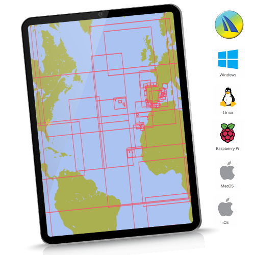
Instant Download Cross Platform for qtVlm. Wide area coverage. Charts cover Spain inc Canaries and Balerics, Portugal inc Azores PLUS Atlantic planning charts. Only 226 charts.
![]()
See hi-res samples, explore coverage. Click here
For the avoidance of doubt, this package covers in detail all major Ports and Harbours within Spain and Portugal waters, plus the Atlantic islands, inc Cape Verdes. It DOES NOT contain detailed chartlets of every small craft harbour/marina/cala on these coasts. Used for passage-making with calls at major harbours (eg La Coruna, Lisbon, Palma, Ibiza, Santa Cruz de Tenerife, etc etc), this chartset is fine. Used in conjunction with a decent pilot book with chartlets it's fine for a proper and deep exploration of these areas. See infographic above.
“qtVlm is a navigation software designed for sailing boats. It is also a free weather grib viewer that accepts all kinds of gribs. It can read and display maps in various formats, including these fully licensed and encrypted raster chartsets”
qtVlm navigation software from: www.meltemus.com
In all cases get, install, familiarise yourself and evaluate qtVlm before buying these charts. How it works:
- Buy the chart coverage you want from the 3 selections available
- Shopping cart will automatically email you the download link and 2 Unlock codes (1 working, 1 backup)
- Install and activate your chartset on your chosen platform. See how: CLICK HERE