Charts for Marine Navigator ES-PT-AT
Stock code: ES-PT-AT
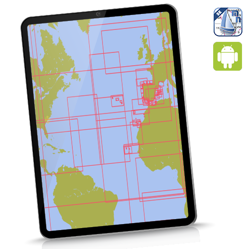
Instant Download for Android devices (needs Marine Navigator app). Wide area coverage. Charts cover Spain inc Canaries and Balerics, Portugal inc Azores PLUS Atlantic planning charts. Only 226 charts.
Windows machines ![]()
See hi-res samples, explore coverage. Click here
For the avoidance of doubt, this package covers in detail all major Ports and Harbours within Spain and Portugal waters, plus the Atlantic islands, inc Cape Verdes. It DOES NOT contain detailed chartlets of every small craft harbour/marina/cala on these coasts. Used for passage-making with calls at major harbours (eg La Coruna, Lisbon, Palma, Ibiza, Santa Cruz de Tenerife, etc etc), this chartset is fine. Used in conjunction with a decent pilot book with chartlets it's fine for a proper and deep exploration of these areas. See infographic above.
Checklist before buying charts:
- Marine Navigator app purchased and installed on device
- Read and understand the EULA
- Read and understand the simple installation and activation process
- Space required: You need double the size of the download as work space..eg the UK-IRL chartset needs 2 GB clear space for installation before download ( you can delete the download after they are installed clearing up 1 GB.)