Unified Charts ES-PT-AT
Stock code: UC-ES-PT-AT
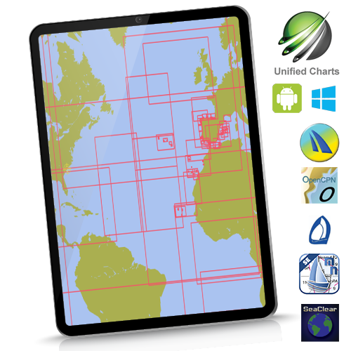
Instant Download for Windows machines. Wide area coverage. Charts cover Spain inc Canaries and Balerics, Portugal inc Azores PLUS Atlantic planning charts. Only 226 charts.
![]()
See hi-res samples, explore coverage. Click here
For the avoidance of doubt, this package covers in detail all major Ports and Harbours within Spain and Portugal waters, plus the Atlantic islands, inc Cape Verdes. It DOES NOT contain detailed chartlets of every small craft harbour/marina/cala on these coasts. Used for passage-making with calls at major harbours (eg La Coruna, Lisbon, Palma, Ibiza, Santa Cruz de Tenerife, etc etc), this chartset is fine. Used in conjunction with a decent pilot book with chartlets it's fine for a proper and deep exploration of these areas. See infographic above.
Unified charts are compatible with nominated WINDOWS programs, not Mac, Linux, etc. The downloadable .iso image versions are licensed for ONE Windows machine, with ONE Windows backup allowed. Those requiring multiple Windows use, please buy the secure USB version.
Matching chartsets are also bundled or downloadable for Marine Navigator Android app or qtVlm app, with 2 mobile device activations allowed... In addition to the standard Windows useage.
Virtual DVD image (.iso) supplied by download. Easy activation process. Cheaper and faster than the USB.
All Unified Chart versions come with a free initial update, including download versions.
So, Unified Charts will work with standard WINDOWS versions of the following:
qtVlm SeaClear OpenCPN Polar View Expedition
Plus Marine Navigator on Android (and qtVlm on Android and iOS)