This 2012 Edition Now REDUCED to just £40, save £29.50
First Class Sea Fishing Marks for the English Channel produced from commercial fisherman’s data by a commercial fisherman.
Now Available ... a special edition of our very popular "Charts for SeaClear" FOR NAVIGATION package... a unique, never seen before set of data that will give you all the edge you need in your leisure fishing. Sea anglers, charter boat operators, potters and even commercial trawlers... these fishing marks are going to change the way you fish.
We are talking about "Trawl Hitches"
A trawl hitch is a geographic spot on the sea bed, where a commercial trawler's nets have "come fast". The nets have become entangled with an underwater obstruction. The results of this can be expensive, nets to be repaired, time lost at sea. It's not surprising then, that commercial trawler skippers keep their own databases of places they've come fast. So they can make sure they avoid costly damage in future. This data is generally jealously guarded for competitive reasons.
But now we have obtained masses of this data and are ready to publish it in the form of "Fishing Marks", overlaid on standard official charts, running in a Windows chart plotter system "SeaClear".

This will enable you to visit these spots and fish.
WHY ?
Because at these spots round fish congregate, and you can catch them ... find out more:
The price is £69.50, plus £1.95 P&P. You get the 12 special fishing charts described below PLUS the standard, FOR NAVIGATION Charts for SeaClear UK/Ireland 2012. (800+ charts) Find out about the standard (non fishing chart) package.. click here.
This 2012 Edition Now REDUCED to just £40, save £29.50

BUY & TRY: This package is covered by our 30 day NO QUIBBLE, money back guarantee. If for ANY reason you don't want this pack after purchase, just return for a full refund. Can't get fairer than that. We are probably the only company making and selling chart packages that have the "Buy with Confidence" logo from Trading Standards
So... what's this all about ?
The data is derived from a number of vessels
and represents years of survey work by commercial
fisherman. This data contains uncharted wrecks,
reefs and marks where trawlers have come fast on the
bottom. These are marks that commercial trawlers avoid as their
trawls get snagged and are areas that provided cover and habitat
for round fish such as Cod, Haddock, Bass, Pollack, Ling, Whiting,
Pout Whiting, Conger and Coalfish. A mark could be a small
reef, outcrop of rock, sunken sea container, uncharted wreck, rough
ground or some other object on the seabed.
"Whilst there is no guarantee that there
are round fish on all of these marks, they do represent the most
likely places where round fish can be found"
It is the case that fish will inhabit these marks for a few days and feed around the mark until the local food source is eaten and then the round fish will then move onto the next mark. A good echo sounder/fish finder will indicate if there are round fish on a mark.
It is important to understand that a
number of marks may have be visited before fish is
found, equally a mark may not have fish on it one day but does the
next day as many of these species of fish move from one mark to
another depending on the food supply.
Contrary to popular belief that round fish can be
found in the lee of a mark this is generally not
the case. Round fish swim into the tide and are generally just up
tide of the mark when feeding. This is because of their in built
survival instinct and the flow of oxygenated water through their
gills. After all fish will reach the safety of a wreck or reef by
swimming down tide quicker and with less energy expended than
swimming up tide to reach safety.
Our database covers the whole of the English Channel from
the Isles of Scilly to Dover and extends towards the French coast.
We also have data for the north coast of Cornwall, Devon, and South
Wales. We have published this data pre-overlaid onto
electronic charts as a complete set of Fishing Charts, that will
run in tandem with the "For Navigation" Charts
for SeaClear DVD or USB.
See the Fishing Charts in a zoomify viewer at full scale
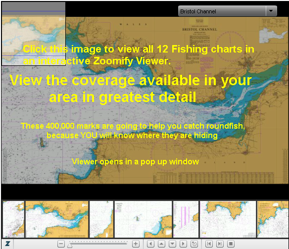
Each fish icon represents a trawl hitch, notice how they seem to form groupings. These marks have been collected over many years by many sources, and they tend to arrange themeselves into identifiable clusters.
This data is first class data and is currently
being used by commercial fisherman including some of the top
earning trawlers. Most of the marks are two or more nautical miles
from the coast and therefore a reasonable vessel is needed to fish
these marks. Without this fishing data your chances of having a
good day’s boat fishing are dramatically reduced and this
data gives the angler a fighting chance of a good days
fishing.
"Fishing Charts for SeaClear 2012" contains all the 400,000+ fishing marks we already have plotted, covering the geographic areas mentioned above... PLUS all the standard "For Nav" charts embedded in the product, covering all UK and Ireland.
If you want to find out what "Charts for SeaClear" actually is and how it works.. check out the standard edition here.
For more information about the "Fishing Charts" being made by VisitMyHarbour call 01983 567866 Office Hours.
![]()
Download PDF users guide..click here
This package will help you (or your charterers) catch more roundfish
The price is £69.50, plus £1.95 P&P. You get the 12 special fishing charts viewable above... PLUS the standard, FOR NAVIGATION Charts for SeaClear UK/Ireland 2012. (800+ charts) Find out about the standard (non fishing chart) package.. click here.
This 2012 Edition Now REDUCED to just £40, save £29.50
BUY & TRY: This package is covered by our 30 day NO QUIBBLE, money back guarantee. If for ANY reason you don't want this pack after purchase, just return for a full refund. Can't get fairer than that. We are probably the only company making and selling chart packages that have the "Buy with Confidence" logo from Trading Standards.
For Commercial Trawlers wishing to use their own established chart plotting systems...
The data can be supplied in GPS exchange format
(GPX Files), Garmin (PCX5/TCX), Raymarine, Magellan, Simrad, Sea
Clear, Sea Pro, Maptech (Offshore Navigator), or Max Sea and
therefore can be imported into most Chart Plotters. Please call if
your chart plotter does not support these files formats as we maybe
able to convert the data into a format your chart plotter supports.
The data is being continually updated and new releases will become
available on an annual basis.
Data is sold as point data which needs to be
overlaid onto a base chart on your chart plotter such as raster
charts or vector charts. The data does not included charts of any
kind. Currently our database consists of over four hundred thousand
fishing marks and is being continually updated and added
to.
The data is sold by areas that are the same areas
as British Admiralty Charts. Prices are £50.00 per chart
area. For advice on suitable charts please call us during office
hours.
Commercial Trawler Skippers wishing to purchase/exchange raw trawl hitch data..Telephone 01752 223295
This data has been collected, collated, cleansed and checked by
Duncan Garratt. Duncan is a certificated commercial trawlerman
with many years experience in the industry, but is also an Army
trained GIS expert.